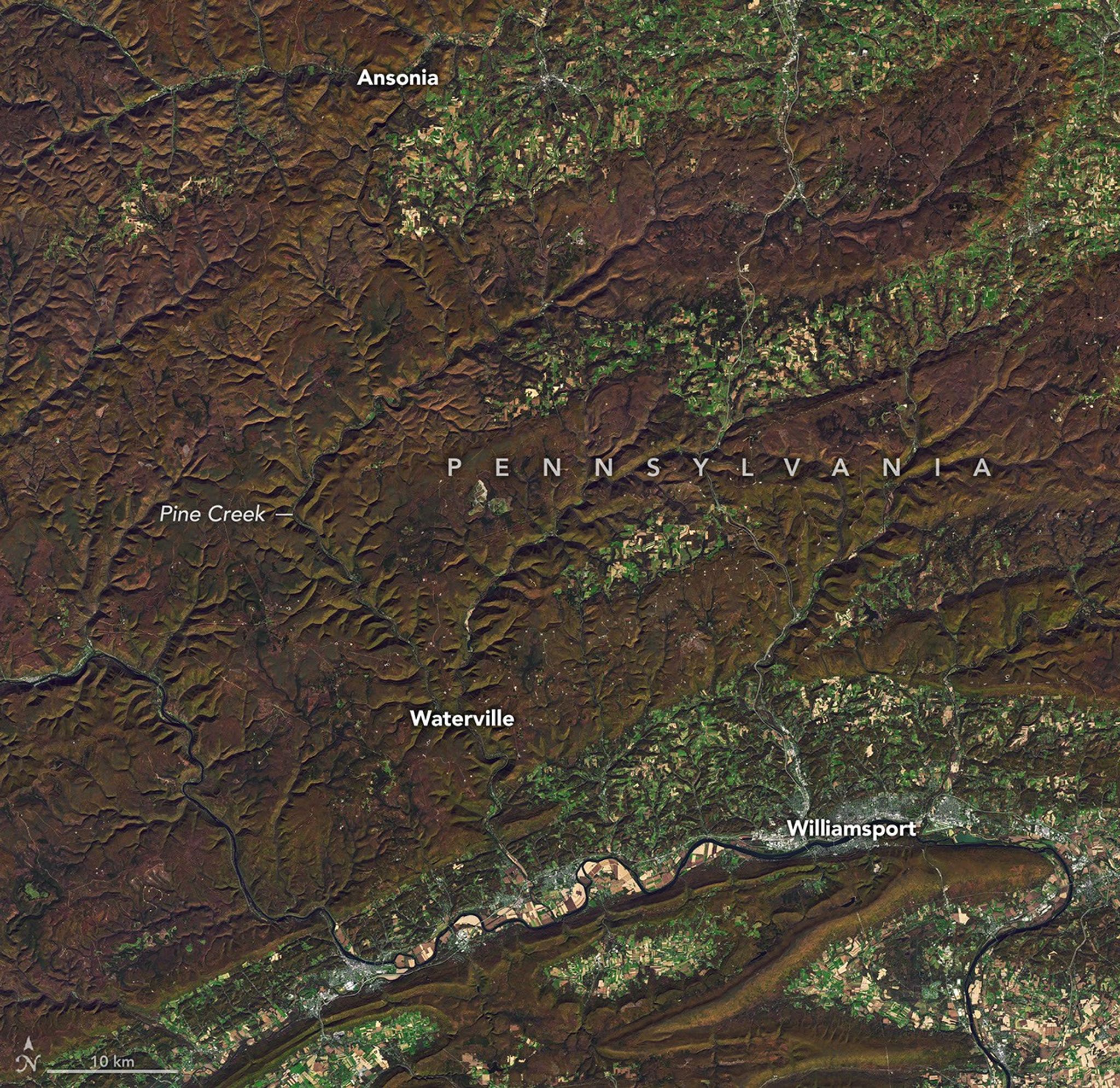
Amid the warm hues of fall foliage, Pine Creek Gorge forms a deep scar in the Allegheny Plateau. North-central Pennsylvania is canyon country with an Appalachian flair.
Amid the warm hues of fall foliage, Pine Creek Gorge forms a deep scar in the Allegheny Plateau. North-central Pennsylvania is canyon country with an Appalachian flair. Pine Creek Gorge reaches depths of about1,500 feet(460 meters) along its gently curving path through the forests of theAllegheny Plateau. Instead of thesteep rock wallscharacteristic of canyons in the desert Southwest, lushly vegetated slopes outline the dramatic topography. In autumn, greens give way to a palette of reds and goldssought outby leaf peepers. Nicknamed the “Grand Canyon of Pennsylvania,” the gorge runs for some 45 miles (72 kilometers) from Ansonia south to Pine Creek’s confluence with the West Branch Susquehanna River, reaching its greatest depths around Waterville. TheOLI(Operational Land Imager) on the NASA-USGSLandsat 8satellite captured this image of Pine Creek Gorge on October 25, 2026, when colorful fall foliage was on display. Glaciers played a key role in the canyon’s formation, though ice itself did not carve it. Pine Creek onceflowed to the north, opposite of what it does today. As glaciers advanced into the region from the northeast during the last ice age, they dammed the river and filled the valley with lakes. Those lakes eventually overflowed, sending water streaming to the south. When the ice receded, Pine Creek was already becoming entrenched in its southward course. Rocks and sand left behind by the melting ice further prevented the water from turning back north. Glacial meltwater continued to rush through the valley, deepening and shaping it into its current form. Today, the hillsides around the gorge are blanketed innorthern hardwoodand mixed oak forest, sprinkled with hemlock and white pine. In autumn, the deciduous trees impartred and gold huesto the landscape akin to the rock of the famousArizona canyon. This seasonal change around Pine Creek Gorge has not always been so visually pleasing. With increasing demand for wood products in early 19th-century America, loggers found their way to the area’s stately trees. At the time, white pine and hemlockseveral feet in diameterand towering hardwoods populated the slopes around Pine Creek Gorge. The pines were especially valued for making ship masts, and hemlock bark was used to tan leather. Before railroads, logs were floated down Pine Creek to the Susquehanna in massive drives. By the early 20th century, decades of logging left the land so barren that the area earned the moniker “Pennsylvania Desert.” The forest has since returned, and with it,wild inhabitantssuch as black bears, coyotes, bobcats, timber rattlesnakes, and a diversity of songbirds. In 1968, an area of 30,000 acres (12,000 hectares) was designated aNational Natural Landmark. Visitors can experience the gorge’s natural splendor at many points along its path, including from multiple state parks and thePine Creek Rail Trail. NASA Earth Observatory images by Michala Garrison, using Landsat data from theU.S. Geological Survey.Photo byfishhawk, via Flickr. Story by Lindsey Doermann. Stay up-to-date with the latest content from NASA as we explore the universe and discover more about our home planet. One narrowing icefall remains the linchpin for the Alpine glacier—and it may not be long for this world. The hills and basins of Seattle, Washington, have been sculpted by glaciers and modified by humans. These glacial landforms jut into northern Lake Huron, surrounded by sheltered channels and coves frequented by fish and small watercraft. Subscribe to the Earth Observatory and get the Earth in your inbox. NASA's Earth Observatory brings you the Earth, every day, with in-depth stories and stunning imagery. Open access to NASA’s archive of Earth science data