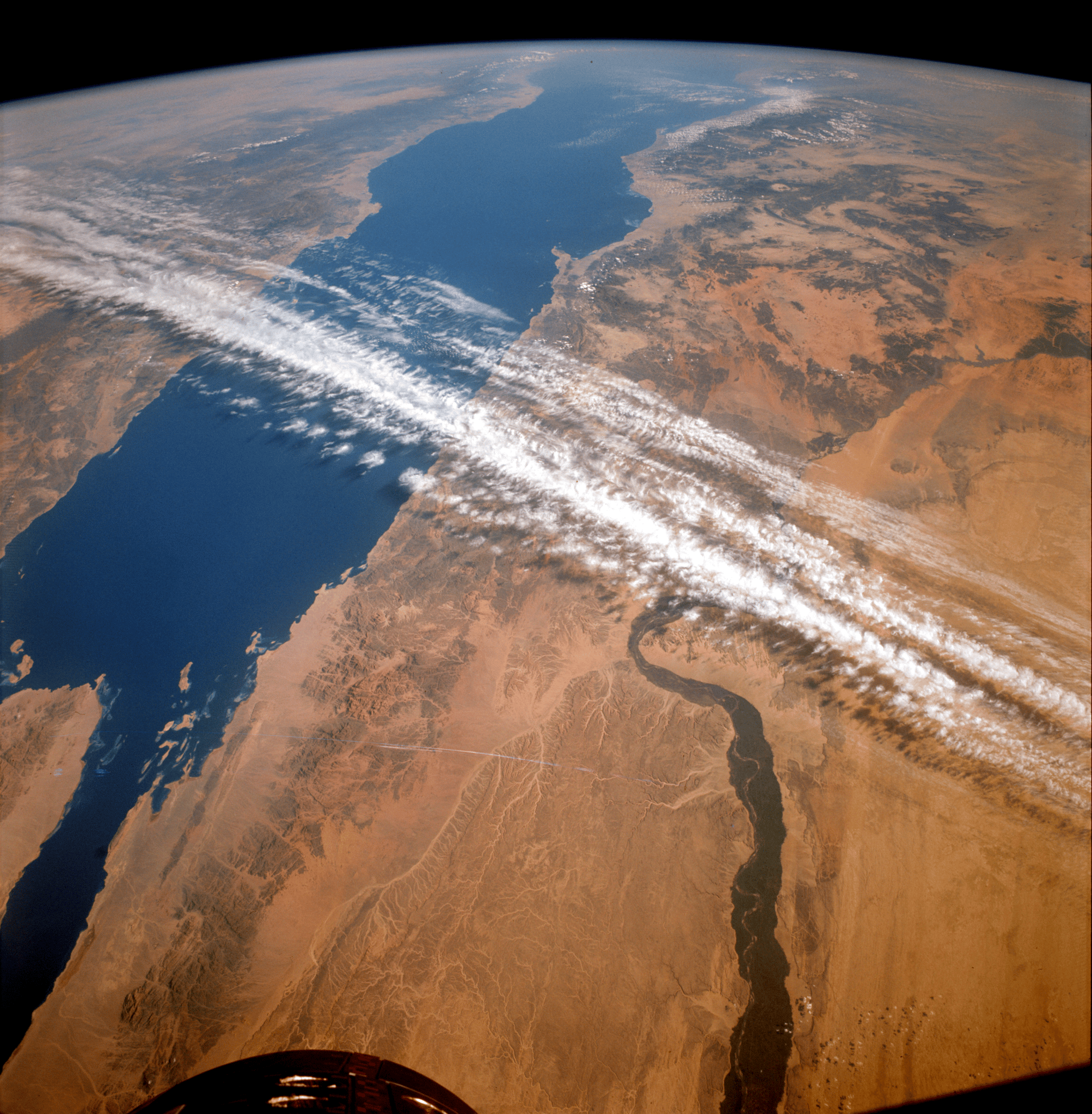
Gemini XII’s astronaut photography proved orbiting cameras could reveal Earth’s surface in new ways, strengthening the case for civilian Earth-observation satellites like Landsat.
From November 11 to 15, 1966, NASA astronauts James A. Lovell Jr. and Edwin E. “Buzz” Aldrin Jr. circled Earth aboard Gemini XII, the final flight of the agency’s Gemini program. The mission is best remembered for sharpening techniques essential to reaching the Moon—precise rendezvous operations and spacewalk procedures among them. But the crew’s time in orbit also helped propel another, less celebrated frontier: using space-based photography to study Earth itself.
Lovell and Aldrin, like other Gemini astronauts, returned with images that underscored how much could be learned from looking down. Their photographs offered clear evidence that orbital views could support scientific analysis of the planet’s surface. In an era when satellite Earth science was still an emerging idea, the Gemini archive served as a practical demonstration: imagery gathered from space could reveal patterns and features on the ground in ways that were difficult to capture from aircraft or field surveys alone.
Those pictures became a key part of the argument for a dedicated civilian Earth-observation satellite effort. One of the most prominent voices pushing for that shift was William T. Pecora, who led the U.S. Geological Survey from 1965 to 1971. Pecora advocated for expanding the nation’s ability to monitor natural resources from orbit and pressed for faster development of Earth-observing satellites.
In a statement delivered in 1969, Pecora pointed directly to the influence of astronaut photography from NASA’s early human spaceflight programs. He wrote that the Earth Resources Observation Satellite program—known as EROS—which he promoted and which later helped lay the groundwork for Landsat, was “conceived in 1966” largely because Mercury and Gemini photos had already demonstrated their value for “Earth resource studies.” In other words, the images taken during missions designed for human spaceflight and lunar preparation also provided a proof-of-concept for systematic environmental monitoring from space.
That legacy has endured for more than 50 years. Landsat and other Earth-observing satellites now supply a continuous stream of global data used by scientists, governments, and industries. The information supports practical decisions and long-term research alike, helping track agricultural conditions, map and assess wildfire impacts, monitor floods, measure vegetation health, and document land-use change. Over time, these satellite records have become foundational for understanding how landscapes evolve—whether from natural variability, extreme weather, or human development.
The story of Gemini XII therefore extends beyond the technical milestones of rendezvous and extravehicular activity. It also illustrates how a handful of astronauts with cameras helped shift perspectives—turning orbital flight into a tool not only for exploring beyond Earth, but also for studying the planet’s resources and changing environment with unprecedented reach.
Why it matters
Earth-observation data now underpin everything from disaster response to agricultural planning and environmental management, affecting communities, businesses, and policymakers worldwide. The push toward programs like EROS—and ultimately Landsat—shows how early spaceflight investments unexpectedly seeded an enduring public scientific capability. As climate and land-use pressures intensify, maintaining long-running satellite records will be crucial for spotting trends, guiding interventions, and measuring whether policies are working.